


Beryl regained hurricane strength late Sunday, barreling toward southern Texas. Its outer bands brought rain and increasing winds as residents braced for the storm that had already carved a deadly path through Mexico and the Caribbean.
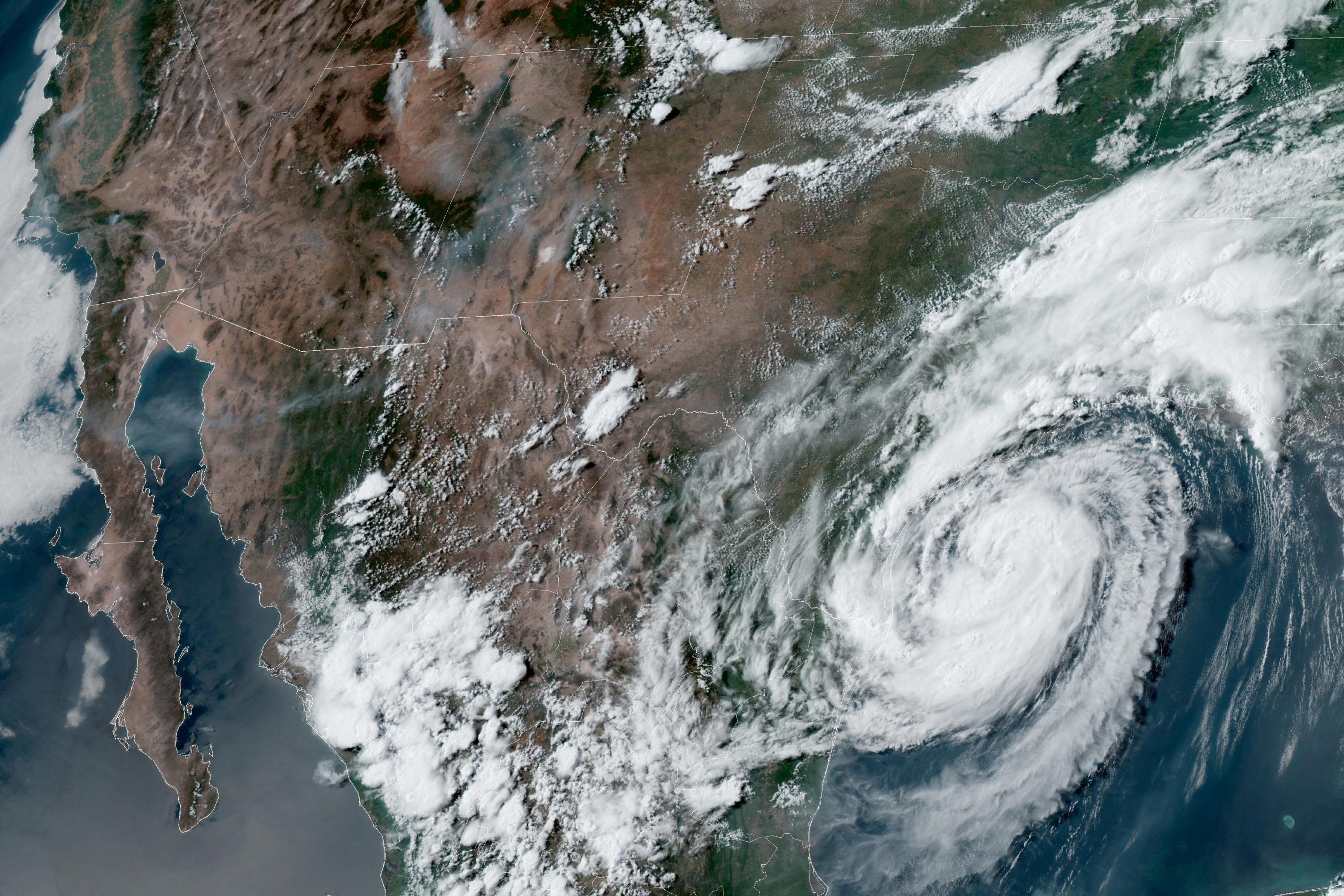
The National Hurricane Center’s 1 a.m. CST update placed Beryl approximately 30 miles southeast of Matagorda, Texas, and 95 miles northeast of Corpus Christi.
The hurricane’s top sustained winds were 80 mph as the storm moved northwest at 10 mph. A hurricane warning is in effect for the Texas coast from Mesquite Bay north to Port Bolivar, the center said.
People on the Texas coast boarded up windows and left beach towns under evacuation orders. The storm was projected to come ashore early Monday in the middle of the Texas coast around Matagorda Bay, an area about 100 miles south of Houston, but officials cautioned the path could still change.
As the storm neared the coast, Texas officials warned Sunday it could cause power outages and flooding but also expressed worry that not enough residents and beach vacationers in Beryl’s path had heeded warnings to leave.
“One of the things that kind of triggers our concern a little bit, we’ve looked at all of the roads leaving the coast and the maps are still green,” said Texas Lt. Gov. Dan Patrick, who is serving as the state’s acting governor while Gov. Greg Abbott is traveling overseas. “So we don’t see many people leaving.”
Tropical storm winds extended 115 miles from the center, and the hurricane center warned residents to be prepared for possible flash flooding in parts of middle, upper and eastern Texas as well as Arkansas as the storm gradually turns to the north and then northeast later Monday.
Along the Texas coast, many residents and business owners took the typical storm precautions but also expressed uncertainty about the storm’s intensity.
In Port Lavaca, Jimmy May fastened plywood over the windows of his electrical supply company and said he wasn’t concerned about the possible storm surge. He recalled his business had escaped flooding in a previous hurricane that brought a 20-foot storm surge.
“In town, you know, if you’re in the low-lying areas, obviously, you need to get out of there,” he said.
At the nearby marina, Percy Roberts showed his neighbor Ken Waller how to properly secure his boat as heavy winds rolled in from the bay Sunday evening.
“This is actually going to be the first hurricane I’m going to be experiencing,” Waller said, noting he is a little nervous but feels safe following Roberts’ lead. “Pray for the best but expect the worst, I guess.”
The earliest storm to develop into a Category 5 hurricane in the Atlantic, Beryl caused at least 11 deaths as it passed through the Caribbean on its way to Texas. The storm ripped off doors, windows and roofs with devastating winds and storm surge fueled by the Atlantic’s record warmth.
Three times during its one week of life, Beryl has gained 35 mph in wind speed in 24 hours or less, the official weather service definition of rapid intensification.
Beryl’s explosive growth into an unprecedented early whopper of a storm indicates the hot water of the Atlantic and Caribbean and what the Atlantic hurricane belt can expect for the rest of the storm season, experts said.
Texas officials warned people along the entire coastline to prepare for possible flooding, heavy rain and wind. The hurricane warning extended from Baffin Bay, south of Corpus Christi, to Sargent, south of Houston.
Beryl lurked as another potential heavy rain event for Houston, where storms in recent months have knocked out power across the nation’s fourth-largest city and flooded neighborhoods. A flash flood watch was in effect for a wide swath of the Texas coast, where forecasters expected Beryl to dump as much as 10 inches of rain in some areas.
Potential storm surges between 4 and 7 feet above ground level were forecast around Matagorda. The warnings extended to the same coastal areas where Hurricane Harvey came ashore in 2017 as a Category 4 hurricane, far more powerful than Beryl’s expected intensity by the time the storm reaches landfall.
Those looking to catch a flight out of the area found a closing window for air travel as Beryl moved closer. Hundreds of flights from Houston’s two major commercial airports were delayed by midafternoon Sunday and dozens more were canceled, according to FlightAware data.
In Corpus Christi, officials asked visitors to cut their trips short and return home early if possible. Residents were advised to secure homes by boarding up windows if necessary and using sandbags to guard against possible flooding.
The White House said Sunday that the Federal Emergency Management Agency had sent emergency responders, search-and-rescue teams, bottled water, and other resources along the coast.
Several coastal counties called for voluntary evacuations in low-lying areas that are prone to flooding. Local officials also banned beach camping and urged tourists traveling on the Fourth of July holiday weekend to move recreational vehicles from coastal parks.
Beryl battered Mexico as a Category 2 hurricane last week, toppling trees but causing no injuries or deaths before weakening to a tropical storm as it moved across the Yucatan Peninsula.
Before hitting Mexico, Beryl wrought destruction in Jamaica, Barbados, and St. Vincent and the Grenadines. Three people were reported dead in Grenada, three in St. Vincent and the Grenadines, three in Venezuela and two in Jamaica.


